The Historic Sunset Highway
in Washington
The Ghost Highway
The Historic Sunset Highway
in Washington
The Ghost Highway
The Ghost Highway: A Forgotten Road in the Northwest Wilderness
Deep within the forest northwest of Lake Easton lies a stretch of the old Sunset Highway, abandoned for nearly 100 years. I call it the Ghost Highway. Why? Because roads are meant to connect places and serve a purpose—but this one leads nowhere, its original function long lost, with no one living nearby.
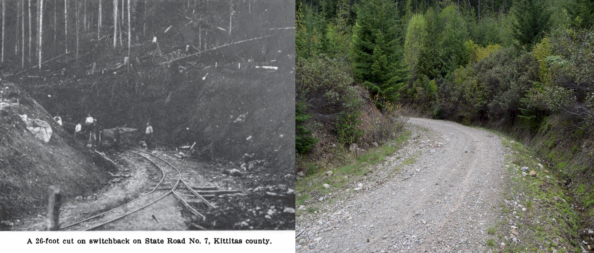
This four-mile section of highway was constructed in 1915, but just 12 years later, in 1927, it was abandoned when the new highway bypassed it. The new route diverged from the old road at the top of Easton Hill, where Midway Park once stood. Midway Park was a small rest stop with a campground, a few cabins, and a Signal gas station. Today, nothing remains of the park—only memories and its ghostly remnants.
Much of the Ghost Highway has reverted back to nature, with dense overgrowth narrowing its once 10ft wide lanes. The first 1.5 miles are still drivable without the need for a four-wheel-drive vehicle, but beyond that, you'll need to continue on foot or by ATV. At the back closer to the freeway the road opens up again as it is accessible from another road coming up from the north on U-Fish Road.
Getting There
To reach the Ghost Highway, take Interstate 90 and exit at Lake Easton State Park (Exit 70). Turn onto West Sparks Road and head under the freeway. This is where the pavement ends, and you'll find yourself on the old highway. After about 1,000 feet, the road veers to the right, marking the beginning of the Ghost Highway.
As you follow the road, it winds uphill along a series of switchbacks. When you reach the top, you'll catch a glimpse of the freeway in the distance—one of only two points along the route where you'll have a view of the surrounding area.
The road continues over the hill and soon opens into a small clearing, which provides a spot to park or turn around. Beyond this point, the road is no longer passable by car, as it fades into the brush and brambles. The brush becomes so thick and tall that you can only see the narrow trail ahead.
Exploring the Ghost Highway
As you walk along, you'll come across the occasional side mirror—left behind by vehicles that tried to push through the overgrowth. After about a half-mile, the road opens up for another half-mile stretch, which is now used as a rough access road, though it appears infrequently traveled. To reach this point, a four-wheel-drive vehicle would be necessary to navigate the terrain up to the old highway.
This part of the road, still winding through the forest, feels untouched by time. The roadbed remains around 20 feet wide, with little debris scattered across it, almost as if the forest has forgotten about this part of the highway.
The final mile of the road, however, is a different story. This section has been completely overtaken by the wilderness since its abandonment in 1927. Downed trees and thick brush block any clear path, making exploration difficult. Climbing over trees and through dense vegetation would be necessary to continue, but I decided to turn back as daylight began to fade.
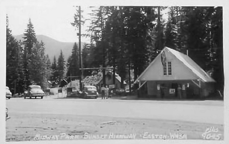
Midway Park - Easton Hill. The dirt road in the background is the old highway. 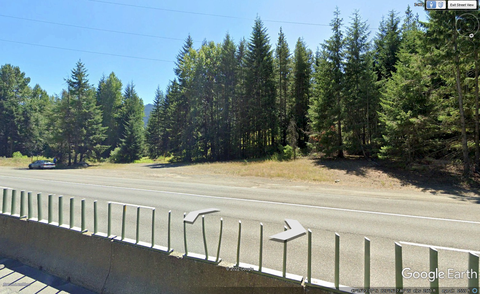
Midway Park today 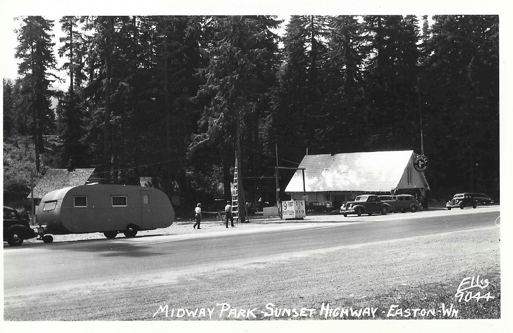
Midway Park - Easton Hill 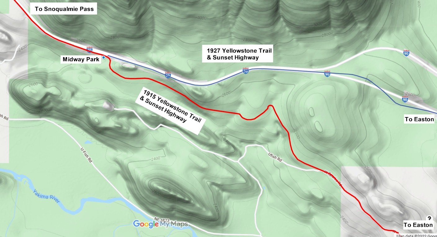
Map of the old and new highways. |
©2014 - 2025 sunset-hwy.com
All Rights Reserved