A Brief History of the Highways
over the Cascade Mountains
in Washington State
By Curt Cunningham
The first wagon road over the Cascade Mountains was constructed in 1853 by the U.S. Military. Known as the Fort Walla Walla
Military Road and the Naches Trail. This rudimentary road connected Fort Steilacoom to Fort Walla
Walla and crossed over Naches Pass. Initially built to facilitate military movements and supply routes,
it became the only western route for the pioneers who wanted to settle in Puget
Sound. Despite its importance, the Naches Trail was notoriously difficult to traverse, with steep grades, narrow paths, and dense forest, making it nearly impassable during wet weather.
Which is why it never saw much traffic as the settlers preferred taking the
Cowlitz Trail from Vancouver to reach Puget Sound.
In 1860, a ferry service began operating across the Columbia River at White
Bluffs. This marked the establishment of the first route across Washington State, linking Puget Sound with Spokane. However, the Naches Trail's poor condition
characterized by steep inclines and unpredictable terrain—led to its replacement by the Snoqualmie
Pass Wagon Road in 1867. This newer road connected with the Naches Trail at Yakima, enabling travelers to head
to either Spokane or Walla Walla. East of the Cascades, the landscape opened up with fewer trees, allowing for easier navigation and travel.
On October 19, 1861, David Maurer filed a petition for a county road from Squak Prairie in Issaquah to Rangers Prairie near
North Bend. The following month, another petition signed by 18 settlers requested a county road from the Black River Bridge in Renton to Squak Prairie. Both petitions were approved, and the
county combined them into a single road stretching from Renton to Rangers Prairie. This road was designated as County Road No. 7. Although it was located and marked, construction did not begin until
1862 and the section between Renton and North Bend was completed about a year
later.
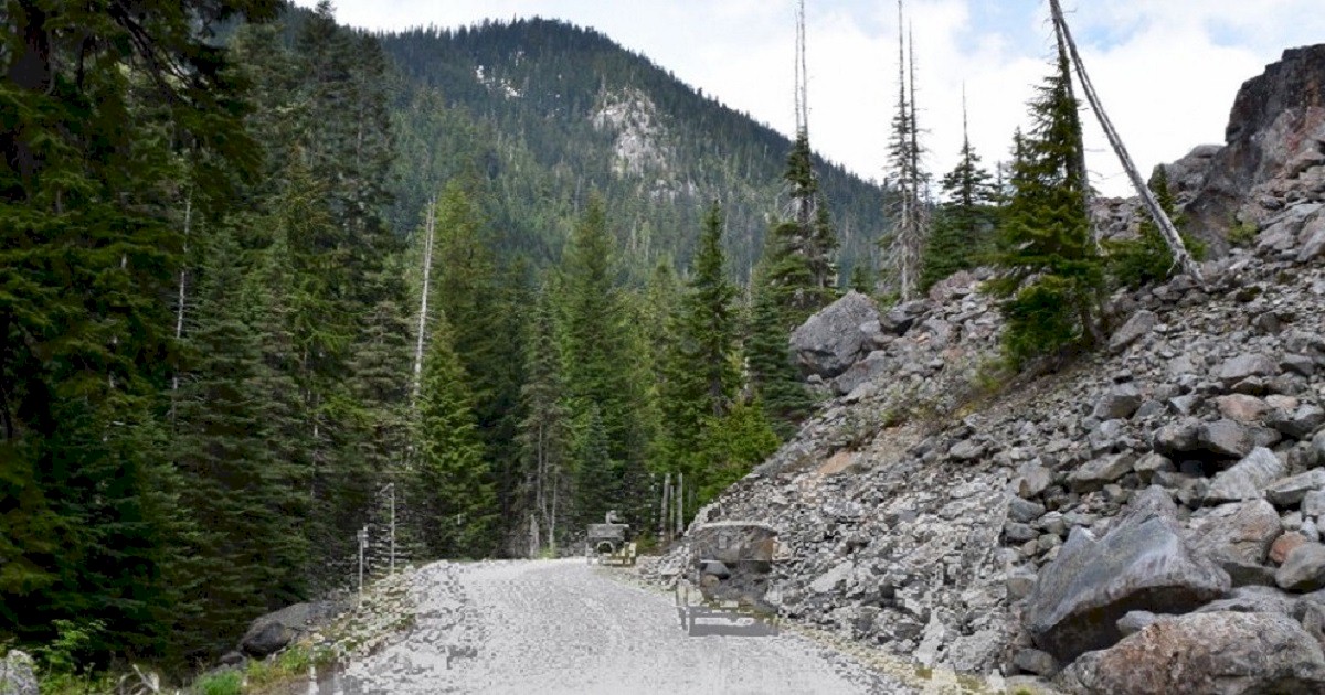
By 1867, the Snoqualmie Pass Wagon Road was completed from
North Bend to Easton, providing an alternative route
over the Cascades. This new road was part of broader infrastructure improvements across the Pacific Northwest to support the growing settler population and agricultural economy. Snoqualmie Pass
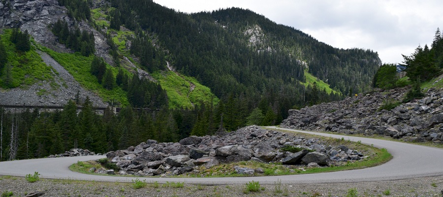
was chosen due to its relatively low elevation, making it more accessible than Yakima or Naches passes.
As the region expanded, transportation became increasingly critical.
The 1906 Biennial Report of the State Highway Department emphasized the importance of State Highway No. 7, calling
it; "the most important trans-mountain road projected." Crossing the Cascades at Snoqualmie Pass, with an elevation of 3,131 feet, it offered the lowest known pass through the range.
The new highway promised lighter grades and shorter distances than other routes. The report also noted that while some sections of the new highway would follow the old wagon road,
much of the original route would be abandoned due to excessive grades, including 25% grades in Kittitas County, which were replaced by gentler slopes of 3% to 5%.
In 1907, State Road No. 7 was established, running between Renton and Spokane. This route incorporated sections
of the Snoqualmie Pass Wagon Road, reflecting the importance of Snoqualmie Pass as a central artery for east-west travel. That same year, the first automobile successfully crossed
Snoqualmie Pass from the eastern side, signaling the start of the automobile era in the region.
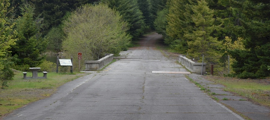
In 1909, the Alaska-Yukon-Pacific Exposition’s transcontinental auto race from New York to Seattle underscored the
urgent need for better roads. During the race, cars were frequently bogged down in mud, particularly along the
sections of the old Snoqualmie Pass Wagon Road. Planking was added in the
worst places and some of this planking is still visible to this day. This event brought widespread public
attention to the poor state of the roads, marking a turning point in Washington State’s development of automobile infrastructure.
In 1913, the Sunset Highway was designated as a primary state highway, and on July 1, 1915, it was officially opened.
The original route began at the Pacific Highway in Renton and extended east to North Bend, crossing Snoqualmie Pass and passing through the towns of Easton, Cle Elum, and Ellensburg.
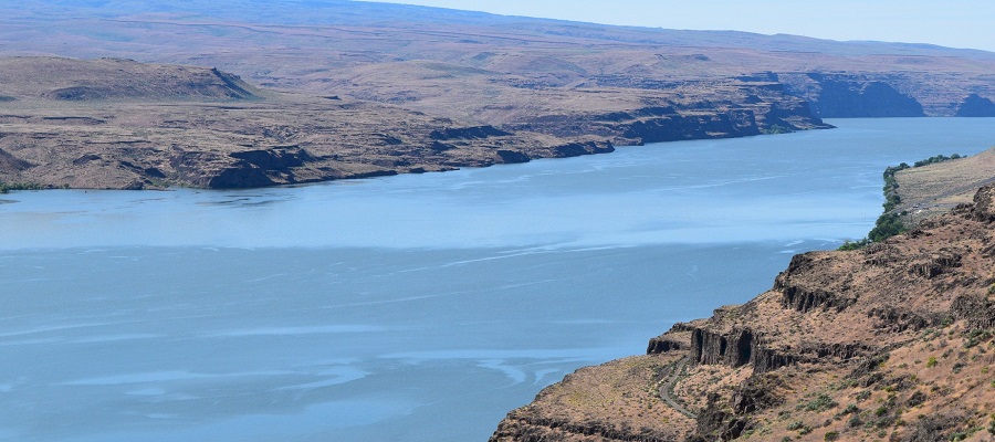
From Ellensburg, the road continued to Vantage, where a ferry crossed the Columbia River. On the eastern side of the river, the road continued north to Quincy, and
then back westward to a second ferry
crossing of the Columbia.
From there, the highway followed the Old Colockum Road north to Wenatchee. Travelers crossed the Columbia River for a
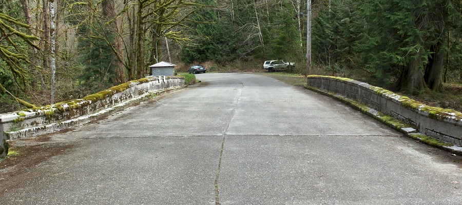
third time via a bridge, continuing north to Waterville before heading east to Spokane. The 1913 completion of the concrete bridge over Latah Creek in Spokane modernized the route, allowing
motorists to bypass the old wagon road and providing a more direct approach to the city.
In 1915 the Yellowstone Trail
reached Seattle and in Washington State the historic transcontinental route
utilized the Sunset Highway beginning at Ellensburg. It quickly became a popular
alternative but at Fall City the route diverged from the Sunset Highway and
instead of going around Lake Washington the route instead crossed directly over
it using the ferry at Kirkland to reach Seattle. In 1925 the Yellowstone Trail
was rerouted in Washington and followed the Sunset Highway proper between
Spokane and Seattle.
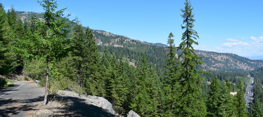
By 1922, the Sunset Highway
was rerouted and improved. After reaching Cle Elum from Seattle, the new route turned north over Blewett Pass
to Peshastin before continuing east to Wenatchee. This reflected broader efforts to establish reliable roadways through the state's rugged terrain. In 1926, the highway was extended to Bothell,
offering motorists the option of traveling around either the north or south ends of Lake Washington.
In the late 1920s, further changes were made to the highway’s route. A new section was built over the hill east of Renton,
connecting to the Pacific Highway just north of Allentown, improving connectivity between key urban areas. By 1934, the entire route between Seattle and Spokane was fully paved with concrete,
marking the completion of one of the state’s most significant transportation projects. Over the years, the highway received several official designations, including State Road No. 2, Primary
State Route No. 2, and U.S. Highway 10.
The Echo Lake cut-off, completed in 1936, allowed motorists to bypass Fall City, Snoqualmie, and North Bend, further
improving travel efficiency across the state. In 1940, the Evergreen Point Floating Bridge was completed, creating a new four-lane highway that bypassed Renton,
giving the highway a direct access to
Seattle and further modernizing Washington's road infrastructure.
Today, much of the original highway has been renamed or replaced by modern highways, yet the name "Sunset Highway"
persists in various locations between Renton and Spokane. The road's evolution reflects the broader history of transportation in Washington State, from its origins as a crude wagon trail to its role as a vital artery in the state's modern highway system.